Scoor, United Kingdom
Landing Point · GB United Kingdom
Connected Cables
| Cable | Status |
|---|---|
| R100 North | Active |
Live Performance
RTT measurements to this landing point from 2026-05-12 through 2026-08-30 - live ICMP round-trip time via our monitoring probes. Recomputed daily. ✓ No anomalies detected in the monitored period.
Measurement sources
| Probe | Location | Samples | Avg |
|---|---|---|---|
| own probe | Minsk BY | 7 | 39.6 ms |
| #6427 own probe | Sydney AU | 6 | 253.4 ms |
| own probe | Kyiv UA | 6 | 48.1 ms |
| #6487 | control probe | 5 | 176.0 ms |
| own probe | Moscow RU | 4 | 47.4 ms |
| own probe | Saint Petersburg RU | 4 | 42.9 ms |
| #7062 own probe | Cape Town ZA | 1 | 150.4 ms |
| own probe | Almaty KZ | 1 | 98.4 ms |
| own probe | Tbilisi GE | 1 | 67.2 ms |
| own probe | Jerusalem IL | 1 | 69.9 ms |
About Scoor, United Kingdom
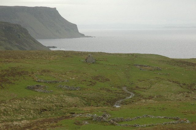
Scoor, United Kingdom: Submarine Cable Landing Point
Scoor is a landing point located in the United Kingdom, situated on the southwestern peninsula of the Isle of Mull, Scotland. As a coastal location on one of Scotland's Inner Hebrides islands, it forms part of the United Kingdom's broader submarine cable infrastructure, which spans 125 landing points across the country. One submarine cable currently lands at Scoor, connecting it to the domestic cable network.
The single cable landing at Scoor is the R100 North, a relatively short domestic cable that links locations entirely within the United Kingdom. Given that both endpoints of this cable are within the same country, the corridor it enables is an intra-national one, most likely serving connectivity between island or remote communities and the Scottish mainland. This positions Scoor as a domestic connectivity landing point rather than an intercontinental gateway.
Cables Landing at Scoor
R100 North is a 224-kilometre submarine cable with a Ready for Service (RFS) year of 2023, currently listed in draft status. The cable connects locations exclusively within the United Kingdom, making it a domestic route. At 224 kilometres, it is considerably shorter than the United Kingdom's average cable length of 1,615 kilometres, reflecting its role in serving a regional or intra-island corridor rather than a long-distance international link.
Regional Context
Within the United Kingdom's network of 125 submarine cable landing points, Scoor hosts a single cable, placing it in the lower tier of landing points by cable count. By comparison, other UK landing points carry significantly heavier traffic: Bude serves eight cables, Lowestoft six, and Blackpool four, while Broadstairs, Porthcurno, and Southport each host three. Scoor's role is therefore more specialised, focused on domestic connectivity to island or remote communities rather than serving as a multi-cable international hub.
Network Role
Scoor functions as a single-cable terminus within the United Kingdom's submarine cable graph. The R100 North cable it hosts is a domestic route, enabling connectivity between Scottish locations - most plausibly supporting access for communities on or around the Isle of Mull that would otherwise rely on limited terrestrial or wireless infrastructure. Its short cable length and purely domestic scope distinguish it clearly from the United Kingdom's internationally oriented landing points.
In the broader regional submarine cable picture, Scoor represents a class of landing point dedicated to bridging geographic isolation within a single country, demonstrating that submarine cable infrastructure serves not only intercontinental communication but also the connectivity needs of remote island communities.
What next: Scoor, United Kingdom in the global directory of cable landing points; see surrounding routes on the interactive submarine cable map or follow live network monitoring.
Other Landing Points in United Kingdom
Landing Point
- CountryGB United Kingdom
- Coordinates56.2917°N 6.1778°W
- Connected Cables1
See Real Cable Routes
View actual submarine cable routing from Scoor, United Kingdom - with backbone nodes, distance calculations, and latency estimates
Open Calculator →