Mahajanga, Madagascar
Landing Point · MG Madagascar
Connected Cables
| Cable | Status |
|---|---|
| 2Africa | Active |
| Djibouti Africa Regional Express 1 (DARE 1) | Active |
Live Performance
RTT measurements to this landing point from 2026-03-08 through 2026-10-10 - live ICMP round-trip time via our monitoring probes. Recomputed daily. ✓ No anomalies detected in the monitored period.
Measurement sources
| Probe | Location | Samples | Avg |
|---|---|---|---|
| own probe | Jerusalem IL | 12 | 186.9 ms |
| #7062 own probe | Cape Town ZA | 9 | 204.2 ms |
| #6410 own probe | Sao Paulo BR | 8 | 309.4 ms |
| #6427 own probe | Sydney AU | 8 | 376.0 ms |
| own probe | Tbilisi GE | 8 | 172.5 ms |
| own probe | Minsk BY | 6 | 176.2 ms |
| own probe | Almaty KZ | 6 | 232.6 ms |
| own probe | Balancer IL | 5 | 186.7 ms |
| #19592 | control probe | 3 | 272.9 ms |
| #60768 | control probe | 3 | 320.4 ms |
| own probe | Sevastopol UA | 2 | 234.7 ms |
| #7827 | control probe | 1 | 307.7 ms |
| own probe | Moscow RU | 1 | 182.6 ms |
| own probe | DVM IL | 1 | 187.1 ms |
About Mahajanga, Madagascar
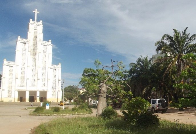
Mahajanga, Madagascar: Submarine Cable Landing Point
Mahajanga is a city situated on the northwest coast of Madagascar and serves as the capital of the Boeny Region. As a submarine cable landing point, it connects Madagascar to a broad set of international destinations across Africa, the Middle East, and beyond. Two submarine cables land at Mahajanga, making it one of Madagascar's most connected landing points and placing it alongside Toliara as the country's leading cable hub by cable count.
The two cables landing at Mahajanga together enable connectivity across both regional African corridors and intercontinental routes reaching as far as the Arabian Peninsula. The 2Africa cable links Mahajanga to countries including Angola, Bahrain, Comoros, Côte d'Ivoire, the Democratic Republic of the Congo, and Djibouti, establishing a wide-ranging intercontinental arc. The Djibouti Africa Regional Express 1 (DARE 1) cable complements this by connecting Mahajanga to Djibouti, Kenya, Mozambique, Somalia, and South Africa, anchoring the city within an East African regional network.
Cables Landing at Mahajanga
2Africa is a submarine cable system spanning 45,000 km with a ready-for-service (RFS) year of 2024. Beyond Mahajanga, this cable reaches Angola, Bahrain, Comoros, Côte d'Ivoire, the Democratic Republic of the Congo, and Djibouti. Its extraordinary length reflects its broad geographic ambition, circling large portions of the African continent and extending into the Middle East, making the Mahajanga landing a point of connection to routes well beyond the immediate East African seaboard.
Djibouti Africa Regional Express 1 (DARE 1) spans 4,854 km and became ready for service in 2021. This cable connects Mahajanga to Djibouti, Kenya, Madagascar (through additional landing points on the island), Mozambique, Somalia, and South Africa. Its comparatively shorter length reflects its focus on knitting together East African coastal nations and reinforcing regional connectivity along the western Indian Ocean rim.
Regional Context
Within Madagascar's four submarine cable landing points, Mahajanga ties with Toliara in hosting the highest number of cables, each receiving two. Fort Dauphin and Toamasina each host a single cable. Mahajanga's position on the northwest coast gives it a distinct geographic orientation compared to these peers, facing toward the East African mainland and the Mozambique Channel.
Network Role
Mahajanga functions as a dual-cable hub within Madagascar's submarine cable infrastructure, rather than a single-cable terminus. Through the combination of 2Africa and DARE 1, the landing point supports both broad intercontinental paths reaching the Middle East and West Africa and tighter regional links running along the East African coast. The two cables complement one another in both geographic reach and vintage, with DARE 1 providing an established regional route since 2021 and 2Africa extending the city's international reach from 2024 onward.
The northwest coast positioning of Mahajanga gives Madagascar a direct entry point into East African cable corridors that runs separately from the connectivity provided by landing points on the island's eastern and southern coasts. In the regional submarine cable graph, Mahajanga's two-cable footprint makes it a meaningful node for ensuring that Madagascar's northwest maintains diverse international routing options.
What next: Mahajanga, Madagascar in the global directory of cable landing points; see surrounding routes on the interactive submarine cable map or follow live network monitoring.
Other Landing Points in Madagascar
Landing Point
- CountryMG Madagascar
- Coordinates15.7137°S 46.3155°E
- Connected Cables2
See Real Cable Routes
View actual submarine cable routing from Mahajanga, Madagascar - with backbone nodes, distance calculations, and latency estimates
Open Calculator →