Lagos, Nigeria
Landing Point · NG Nigeria
Connected Cables
| Cable | Status |
|---|---|
| 2Africa | Active |
| Africa Coast to Europe (ACE) | Active |
| Equiano | Active |
| Glo-1 | Active |
| MainOne | Active |
| Nigeria Cameroon Submarine Cable System (NCSCS) | Active |
| SAT-3/WASC | Active |
| West Africa Cable System (WACS) | Active |
Live Performance
RTT measurements to this landing point from 2026-03-06 through 2026-10-17 - live ICMP round-trip time via our monitoring probes. Recomputed daily.
Measurement sources
| Probe | Location | Samples | Avg |
|---|---|---|---|
| #7050 | control probe | 180 | 139.3 ms |
| #724 | control probe | 132 | 158.9 ms |
| own probe | Jerusalem IL | 42 | 174.0 ms |
| #6427 own probe | Sydney AU | 34 | 391.1 ms |
| own probe | Balancer IL | 33 | 258.5 ms |
| own probe | Minsk BY | 19 | 203.3 ms |
| own probe | Almaty KZ | 18 | 219.6 ms |
| own probe | Tbilisi GE | 18 | 240.7 ms |
| own probe | Sevastopol UA | 14 | 232.3 ms |
| #7062 own probe | Cape Town ZA | 12 | 58.2 ms |
| #6410 own probe | Sao Paulo BR | 8 | 289.9 ms |
| own probe | DVM IL | 8 | 247.7 ms |
| #6568 own probe | Singapore SG | 7 | 289.6 ms |
| own probe | Moscow RU | 7 | 246.1 ms |
| own probe | Saint Petersburg RU | 7 | 229.4 ms |
| own probe | Rostov RU | 7 | 256.6 ms |
| own probe | Odessa UA | 7 | 152.0 ms |
| own probe | Kyiv UA | 7 | 149.6 ms |
| own probe | Ekaterinburg RU | 7 | 266.7 ms |
| #6487 | control probe | 2 | 250.8 ms |
About Lagos, Nigeria
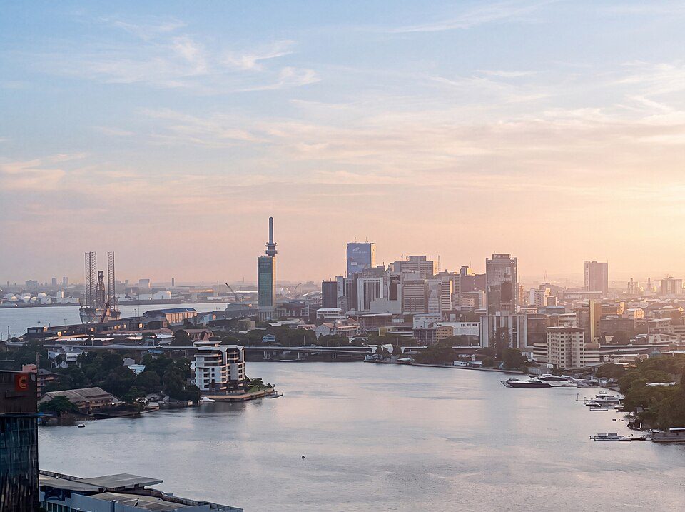
Lagos, Nigeria is a submarine cable landing point in Nigeria (coordinates 6.4389°, 3.4232°). It serves 8 submarine cable systems, making it a significant node in Nigeria's international connectivity infrastructure.
Lagos, or Lagos City, is a large metropolitan port city in southwestern Nigeria. As of November 2025, the size of the city's population has been estimated to be between 17 and 21 million residents, making Lagos the largest city in Nigeria, the most populous urban area on the African continent, and one of the fastest-growing megacities in the world. Lagos was the national capital of Nigeria until the government's December 1991 decision to relocate its capital to Abuja, in the centre of the country. Apart from serving as a major African financial center, Lagos has also played a significant role in the national economy, serving as the economic hub of Lagos State and the entire country of Nigeria. The city has a significant influence on commerce, entertainment, technology, education, politics, tourism, art, and fashion in Africa. Lagos is also among the top ten of the world's fastest-growing cities and urban areas. A megacity, it has the second-highest GDP in Africa, and houses one of the largest and busiest seaports on the continent. Due to the large urban population and port traffic volumes, Lagos is classified as a Medium-Port Megacity. Wikipedia
Connected submarine cables
| Cable | RFS | Length | Owners |
|---|---|---|---|
| 2Africa | 2024 | 45,000 km | Bayobab, China Mobile, Meta, … |
| Equiano | 2023 | 15,000 km | |
| Nigeria Cameroon Submarine Cable System (NCSCS) | 2015 | 1,100 km | Camtel |
| Africa Coast to Europe (ACE) | 2012 | 17,000 km | Bayobab, Cable Consortium of Liberia, Canalink, … |
| West Africa Cable System (WACS) | 2012 | 14,530 km | Altice Portugal, Angola Cables, Bayobab, … |
| Glo-1 | 2010 | 9,800 km | Globacom Limited |
| MainOne | 2010 | 7,000 km | MainOne - An Equinix Company |
| SAT-3/WASC | 2002 | 14,350 km | AT&T, Altice Portugal, Angola Telecom, … |
Operators landing at Lagos, Nigeria
Cables landing at Lagos, Nigeria are operated by 68 distinct consortium partners and carriers, including AT&T, Altice Portugal, Angola Cables, Angola Telecom, BICS, BT, Bayobab, Broadband Infraco, Cable Consortium of Liberia, Camtel, and 58 others. Each cable is typically jointly owned by a consortium of tier-one carriers and hyperscale operators who share construction costs and capacity; the operator mix reflects both regional incumbents and global players with interest in the routes served by this landing point.
Connectivity profile
From Lagos, Nigeria, international traffic can reach 48 countries through 8 cable systems. Destinations include Angola, Ascension and Tristan da Cunha, Bahrain, Benin, Cameroon, Cape Verde, Comoros, Côte d'Ivoire and 40 more. With multiple redundant paths, traffic at this landing point can reroute through alternative cables if any single system experiences an outage.
Monitoring status
GeoCables recorded 3 monitoring events on cables serving Lagos, Nigeria in the past 90 days. Our monitoring network continuously samples latency from external probes to targets reachable via these cables.
About the cables
- 2Africa (2024) - 2Africa is a 45,000-kilometre submarine cable system that encircles the African continent and extends into the Middle East and Europe. At the time of its completion in 2024, it became the longest submarine cable ever built - by a margin of several thousand kilometres - and it remains the largest single system by landing count, with 46 landings across 33 countries. Read more →
- Equiano (2023) - Equiano is Google's privately-funded submarine cable system connecting Europe and Africa. Activated in stages between 2022 and 2023, it runs roughly 15,000 km from Sesimbra in Portugal down the entire west coast of Africa to Melkbosstrand near Cape Town, with branch landings at Lagos (Nigeria), Lomé (Togo), Swakopmund (Namibia), and the remote British Overseas Territory of Saint Helena. Read more →
- Nigeria Cameroon Submarine Cable System (NCSCS) (2015) - The Nigeria Cameroon Submarine Cable System (NCSCS) is a short, single-owner cable that reveals a textbook story about African internet economics: a 1,100-kilometre fibre linking two neighbours whose actual latency, as measured from the outside, depends far more on commercial routing than on physics. Read more →
- Africa Coast to Europe (ACE) (2012) - Africa Coast to Europe (ACE) is a 17,000 km submarine cable that runs along the entire Atlantic coast of West Africa and ends in France. It lands at 19 stations across 19 countries, which makes it one of the most widely-landed submarine cables in the world. Read more →
- West Africa Cable System (WACS) (2012) - The West Africa Cable System (WACS) is a 14,530 km submarine cable constructed by Alcatel-Lucent and ready for service in 2012. It runs from Yzerfontein in South Africa's Western Cape up the entire west coast of Africa to London, with 14 landing points - 12 along the African seaboard (Namibia, Angola, both Congos, Cameroon, Nigeria, Ghana, Côte d'Ivoire, Togo, Cape Verde) plus two in Europe (Canar Read more →
- Glo-1 (2010) - Glo-1 is a cross-regional submarine cable connecting Ghana, United Kingdom, Nigeria. Its 3 landing points at Accra, Bude, Lagos bridge the networks of West Africa, Europe, providing an important path for international data traffic. Read more →
- MainOne (2010) - MainOne is a cross-regional submarine cable connecting Côte d'Ivoire, Ghana, Senegal, Nigeria, Portugal. Its 5 landing points at Abidjan, Accra, Dakar, Lagos, Seixal bridge the networks of West Africa, Europe, providing an important path for international data traffic. Read more →
- SAT-3/WASC (2002) - Based on 58 RIPE Atlas measurements from GeoCables monitoring infrastructure, March-April 2026. SAT-3/WASC - the South Atlantic Terminal / West Africa Submarine Cable - is, on paper, a fossil. Its 14,350 kilometres of fibre were laid down in 2002 on behalf of a consortium of 32 telecom operators, ranging from AT&T and BT to Maroc Telecom and Angola Telecom. Read more →
What next: Lagos, Nigeria in the global directory of cable landing points; see surrounding routes on the interactive submarine cable map or follow live network monitoring.
Incident history
Significant incidents on cables landing here, each with its own report.
- Nigeria Cameroon Submarine Cable System (NCSCS): latency up to 88.6× normal, 6 Oct 2026 (resolved)
- Nigeria Cameroon Submarine Cable System (NCSCS): latency up to 9.2× normal, 5 Aug 2026 (resolved)
Other Landing Points in Nigeria
FAQ
Landing Point
- CountryNG Nigeria
- Coordinates6.4389°N 3.4232°E
- Connected Cables8
See Real Cable Routes
View actual submarine cable routing from Lagos, Nigeria - with backbone nodes, distance calculations, and latency estimates
Open Calculator →