Ilo, Peru
Landing Point · PE Peru
1
Connected Cables
PE
Country
17.64°
Latitude
71.32°
Longitude
Ctrl + Scroll to zoom
Connected Cables
| Cable | Status |
|---|---|
| Fibra Optica al Pacífico | Active |
Live Performance
76
measurements
12
probes
162
days monitored
242.0
ms avg RTT
0
anomalies
RTT measurements to this landing point from 2026-03-09 through 2026-08-18 - live ICMP round-trip time via our monitoring probes. Recomputed daily. ✓ No anomalies detected in the monitored period.
Measurement sources
| Probe | Location | Samples | Avg |
|---|---|---|---|
| #6410 own probe | Sao Paulo BR | 13 | 90.1 ms |
| #6487 | control probe | 13 | 330.9 ms |
| #7062 own probe | Cape Town ZA | 13 | 439.7 ms |
| own probe | Minsk BY | 9 | 204.6 ms |
| own probe | Almaty KZ | 8 | 265.2 ms |
| own probe | Tbilisi GE | 5 | 230.2 ms |
| own probe | Jerusalem IL | 4 | 231.4 ms |
| own probe | Moscow RU | 3 | 202.1 ms |
| #7163 | control probe | 2 | 15.4 ms |
| #1015159 | control probe | 2 | 15.9 ms |
| #1015204 | control probe | 2 | 14.3 ms |
| own probe | Sevastopol UA | 2 | 234.7 ms |
About Ilo, Peru
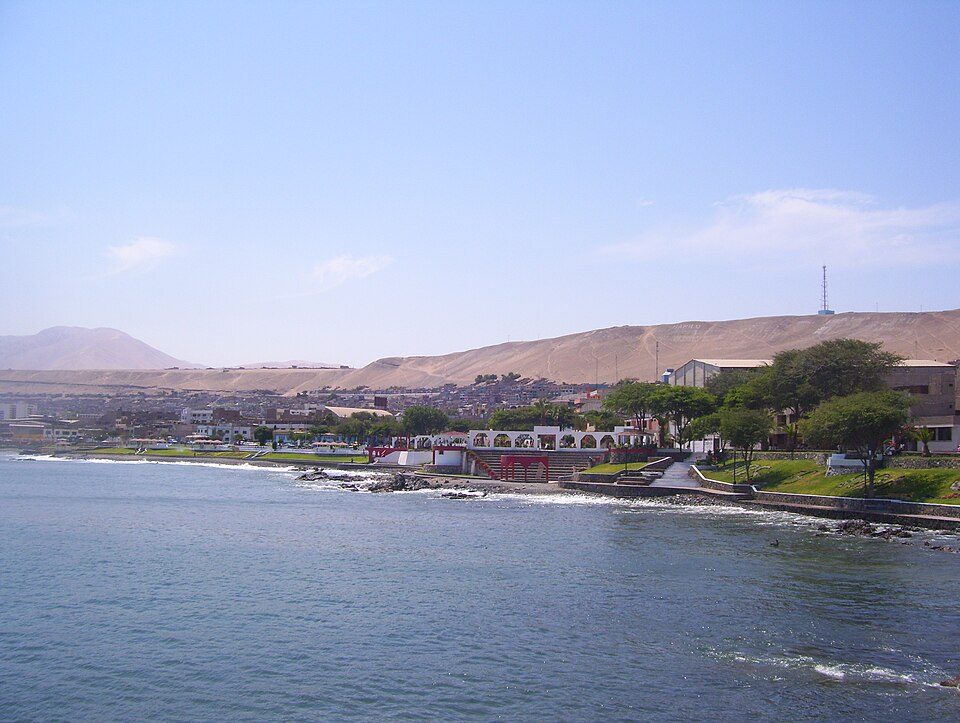
Connectivity in Ilo, Peru: A Gateway to the Pacific
Ilo, a port city in southern Peru, plays a modest but important role in the country's submarine cable network. Despite hosting only one cable, Fibra Optica al Pacífico, Ilo connects the region to Peru's broader digital infrastructure. This single cable, operational since 2020, links Ilo to Lurin, another landing point closer to the capital, Lima. Together, they form a domestic chain that stitches Peru's Pacific coastline into a cohesive network.Fibra Optica al Pacífico: Ilo's Digital Anchor
The Fibra Optica al Pacífico cable spans 1180 km, making it a relatively short route compared to Peru's other cables. It is purely domestic, connecting Ilo to Lurin without extending internationally. This cable is part of Peru's ongoing efforts to strengthen internal connectivity, ensuring that even cities far from Lima, like Ilo, have reliable access to the country's digital infrastructure. While Ilo hosts just one cable, it stands alongside Lurin, which is home to four cables, and Mancora, another single-cable landing point in northern Peru. This distribution highlights Ilo's role as a regional connector rather than a major hub. Its presence ensures that southern Peru remains plugged into the national network, supporting local industries and the port's operations.Latency Insights: Ilo's Performance
GeoCables' unique latency measurements provide valuable insights into Ilo's connectivity. Over 62 completed checks from 12 source cities, the average round-trip latency to Ilo was 272 ms, with the best observed latency reaching 79 ms. These figures reflect the efficiency of the domestic cable network in delivering data to and from this southern port city. While not as fast as connections to major hubs, Ilo's latency performance is more than adequate for regional needs.The Port City of Ilo
Ilo itself is a city of 66,118 residents, known for its port and position as the capital of the Ilo Province in the Moquegua Region. The city's economy revolves around shipping, fishing, and local industries, which benefit from the connectivity provided by the Fibra Optica al Pacífico cable. While Ilo may not be a technological powerhouse, its inclusion in the submarine cable network ensures that the region can participate in Peru's growing digital economy.Conclusion: A Small but Steady Link
Ilo's single cable may seem modest compared to Lurin's four, but it serves an important purpose. As a southern anchor in Peru's domestic cable network, Ilo ensures that the Moquegua Region stays connected to the rest of the country. Its role may not be as prominent as other landing points, but it is a steady link in the chain that ties Peru's Pacific coastline together.What next: Ilo, Peru in the global directory of cable landing points; see surrounding routes on the interactive submarine cable map or follow live network monitoring.
Other Landing Points in Peru
Landing Point
- CountryPE Peru
- Coordinates17.6412°S 71.3237°W
- Connected Cables1
See Real Cable Routes
View actual submarine cable routing from Ilo, Peru - with backbone nodes, distance calculations, and latency estimates
Open Calculator →
Submarine cables
Land fiber
Live probes