Girne, Cyprus
Landing Point · CY Cyprus
Connected Cables
| Cable | Status |
|---|---|
| Turcyos-1 | Active |
Live Performance
RTT measurements to this landing point from 2026-05-06 through 2026-10-14 - live ICMP round-trip time via our monitoring probes. Recomputed daily. ✓ No anomalies detected in the monitored period.
Measurement sources
| Probe | Location | Samples | Avg |
|---|---|---|---|
| own probe | Jerusalem IL | 9 | 110.8 ms |
| #6427 own probe | Sydney AU | 8 | 361.5 ms |
| own probe | Balancer IL | 7 | 85.8 ms |
| own probe | Tbilisi GE | 3 | 99.5 ms |
| #6410 own probe | Sao Paulo BR | 2 | 243.5 ms |
| own probe | Minsk BY | 1 | 82.9 ms |
| own probe | Almaty KZ | 1 | 141.1 ms |
| own probe | Sevastopol UA | 1 | 129.4 ms |
| own probe | Moscow RU | 1 | 95.8 ms |
| own probe | Saint Petersburg RU | 1 | 98.8 ms |
About Girne, Cyprus
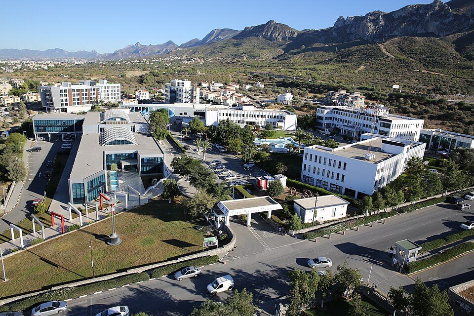
Girne, Cyprus: Submarine Cable Landing Point
Girne is a coastal city in Cyprus, situated on the northern shore of the island. As a submarine cable landing point, Girne connects Cyprus directly to Turkey via undersea infrastructure. One submarine cable lands at Girne, establishing a short bilateral link across the northeastern Mediterranean corridor between Cyprus and the Turkish mainland.
The single cable landing at Girne, Turcyos-1, represents a regional connection rather than an intercontinental route, spanning just 110 kilometres and linking the island to its nearest northern neighbour. This positions Girne as a focused, single-purpose landing point within Cyprus's broader submarine cable geography.
Cables Landing at Girne
Turcyos-1 is a submarine cable 110 kilometres in length, with a ready-for-service date of 1993, making it one of the earliest submarine cable deployments in Cyprus. The cable connects Girne, Cyprus to Turkey, forming a direct bilateral link across a short stretch of the Mediterranean Sea. Turcyos-1 currently carries a draft status designation. Its endpoints span two countries - Cyprus and Turkey - defining a compact but direct bilateral corridor in the northeastern Mediterranean.
Regional Context
Within Cyprus, four landing points collectively host 13 submarine cables. Pentaskhinos and Yeroskipos each serve as the island's most connected landing points, each hosting six cables, while Iskele hosts one cable - the same count as Girne. Girne therefore shares the lower tier of connectivity within the national submarine cable network, ranking alongside Iskele rather than the more heavily served southern landing points. Despite its modest cable count, Girne holds the distinction of hosting Cyprus's earliest recorded cable landing, with Turcyos-1 dated to 1993.
Network Role
Girne functions as a single-cable terminus rather than a multi-cable hub, with its sole connection dedicated entirely to the Cyprus-Turkey corridor. The Turcyos-1 cable enables a direct bilateral link between the two countries across a distance of just 110 kilometres, representing one of the shortest submarine cable spans within Cyprus's overall infrastructure portfolio, where the average cable length is approximately 3,988 kilometres. This stands in marked contrast to the longer-reach international cables that terminate at Pentaskhinos and Yeroskipos.
Within the regional submarine cable graph, Girne's role is narrow but distinct: it provides a dedicated point-to-point connection on the Cyprus-Turkey axis, separate from the multi-country routes served elsewhere on the island. As the only landing point on Cyprus's northern coast documented with cable infrastructure, its position in the regional network reflects the geographic proximity of the two countries it bridges.
What next: Girne, Cyprus in the global directory of cable landing points; see surrounding routes on the interactive submarine cable map or follow live network monitoring.
Other Landing Points in Cyprus
Landing Point
- CountryCY Cyprus
- Coordinates35.2991°N 33.2363°E
- Connected Cables1
See Real Cable Routes
View actual submarine cable routing from Girne, Cyprus - with backbone nodes, distance calculations, and latency estimates
Open Calculator →