Cockburn Town, Bahamas
Landing Point · BS Bahamas
Connected Cables
| Cable | Status |
|---|---|
| Bahamas Domestic Submarine Network (BDSNi) | Active |
Live Performance
RTT measurements to this landing point from 2026-07-12 through 2026-07-12 - live ICMP round-trip time via our monitoring probes. Recomputed daily. ✓ No anomalies detected in the monitored period.
Measurement sources
| Probe | Location | Samples | Avg |
|---|---|---|---|
| #6410 own probe | Sao Paulo BR | 2 | 132.3 ms |
| #6427 own probe | Sydney AU | 2 | 294.7 ms |
| #6487 | control probe | 2 | 256.1 ms |
| own probe | Minsk BY | 2 | 159.8 ms |
| own probe | Saint Petersburg RU | 2 | 147.5 ms |
| own probe | Kyiv UA | 2 | 171.5 ms |
About Cockburn Town, Bahamas
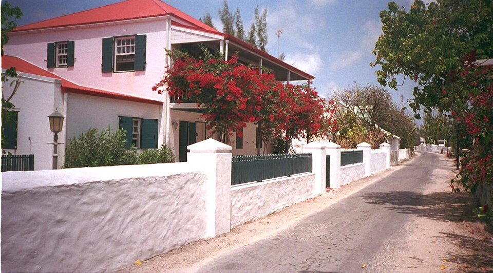
Cockburn Town, Bahamas: Submarine Cable Landing Point
Cockburn Town is a landing point in the Bahamas, situated within an archipelagic nation whose submarine cable infrastructure spans 21 landing points across 5 cables. As an island-nation context, submarine cables connecting its communities and neighboring countries serve inter-island and regional corridor functions. One submarine cable lands at Cockburn Town, linking it to the broader regional network that extends across the Bahamas and to Haiti.
The single cable landing here, the Bahamas Domestic Submarine Network (BDSNi), reflects the role Cockburn Town plays as a node within a distributed island communications framework. The BDSNi connects multiple points within the Bahamas and reaches Haiti, establishing a corridor that bridges domestic Bahamian connectivity with a neighboring Caribbean nation.
Cables Landing at Cockburn Town, Bahamas
The Bahamas Domestic Submarine Network (BDSNi) is the sole submarine cable landing at Cockburn Town. Stretching 2,735 km, this cable reached ready-for-service status in 2006 as a draft system. Its route connects landing points within the Bahamas and extends to Haiti, making it a cable that serves both intra-Bahamian domestic connectivity and an international link to Haiti. The BDSNi is one of the longer cables in the Bahamian submarine network, sitting slightly above the national average cable length of 2,674 km recorded across the country's submarine infrastructure.
Regional Context
Within the Bahamas, Cockburn Town ranks alongside Alice Town as one of the landing points hosting a single cable, placing it in the lower tier of the country's 21 landing points by cable count. Nassau leads the national network with three cables, while Cat Island, Eight-Mile Rock, Hawksbill, and Sandy Point each host two cables. Cockburn Town's position in the top 76 percent of Bahamian landing points by cable count reflects the broadly distributed nature of submarine cable infrastructure across the archipelago, where many individual island communities are served by a dedicated connection.
Network Role
Cockburn Town functions as a single-cable terminus within the regional submarine cable graph. Its connection via the BDSNi supports both domestic inter-island communications within the Bahamas and an international link reaching Haiti. The cable's 2,735 km length and multi-country scope mean that Cockburn Town is not an isolated endpoint but rather one stop on a longer regional route that ties together Bahamian and Haitian connectivity.
As a single-cable landing point in a country where the average landing point hosts connections to the national cable network, Cockburn Town represents the reach of the BDSNi into a specific part of the Bahamian archipelago. Its presence in the regional submarine cable graph helps illustrate how island nations distribute connectivity across geographically dispersed communities through a shared cable system.
What next: Cockburn Town, Bahamas in the global directory of cable landing points; see surrounding routes on the interactive submarine cable map or follow live network monitoring.
Other Landing Points in Bahamas
Landing Point
- CountryBS Bahamas
- Coordinates24.0525°N 74.5302°W
- Connected Cables1
See Real Cable Routes
View actual submarine cable routing from Cockburn Town, Bahamas - with backbone nodes, distance calculations, and latency estimates
Open Calculator →