Cavite, Philippines
Landing Point · PH Philippines
Connected Cables
| Cable | Status |
|---|---|
| EAC-C2C | Active |
Live Performance
RTT measurements to this landing point from 2026-04-13 through 2026-09-18 - live ICMP round-trip time via our monitoring probes. Recomputed daily. ✓ No anomalies detected in the monitored period.
Measurement sources
| Probe | Location | Samples | Avg |
|---|---|---|---|
| own probe | Almaty KZ | 45 | 289.1 ms |
| #6410 own probe | Sao Paulo BR | 44 | 371.8 ms |
| #6487 | control probe | 39 | 36.1 ms |
| #6427 own probe | Sydney AU | 11 | 191.1 ms |
| #7062 own probe | Cape Town ZA | 9 | 312.4 ms |
| #22471 | control probe | 6 | 21.4 ms |
| #61622 | control probe | 6 | 20.5 ms |
| own probe | Tbilisi GE | 6 | 289.5 ms |
| own probe | Minsk BY | 3 | 257.2 ms |
| own probe | Jerusalem IL | 2 | 318.4 ms |
| own probe | Moscow RU | 2 | 240.4 ms |
| #1009707 | control probe | 1 | 27.6 ms |
| own probe | Sevastopol UA | 1 | 270.3 ms |
| own probe | Rostov RU | 1 | 279.2 ms |
About Cavite, Philippines
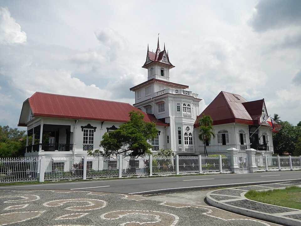
Cavite, Philippines: Submarine Cable Landing Point
Cavite is a province of the Philippines located in the Calabarzon region, situated along the southern shores of Manila Bay. As a coastal province, it forms part of the Philippines' submarine cable infrastructure, hosting one international submarine cable landing. The Philippines as a whole accommodates 26 submarine cables across 71 landing points, and Cavite contributes to that network as the terminus of a major transoceanic system connecting multiple economies across East and Southeast Asia.
The single cable landing at Cavite is the EAC-C2C, a long-haul system that links the Philippines with China, Japan, Singapore, South Korea, and Taiwan. This cable positions Cavite as a node within an intra-Asia and broader Asia-Pacific corridor, enabling connectivity across some of the region's most significant telecommunications markets.
Cables Landing at Cavite, Philippines
EAC-C2C is a submarine cable system spanning 36,500 kilometres that reached ready-for-service status in 2002. The system connects Cavite, Philippines with landing points in China, Japan, Singapore, South Korea, and Taiwan. Its route encompasses a wide sweep of East and Southeast Asian coastlines, making it one of the longer regional cable systems to include a Philippine landing point. Cavite serves as one of the Philippine terminations on this cable, integrating the province into a network that spans six countries across the Asia-Pacific region.
Regional Context
Within the Philippines, Cavite hosts fewer cables than several of the country's more prominent landing points. Batangas, Cagayan de Oro, Davao, and Taytay each accommodate four cables, while Baler and Boracay each host three. With one cable, Cavite ranks in the top 55 percent of the Philippines' 71 landing points by cable count, placing it in the middle tier of the national submarine cable geography.
Network Role
Cavite functions as a single-cable terminus rather than a multi-cable hub. Its connection through EAC-C2C reaches five other countries - China, Japan, Singapore, South Korea, and Taiwan - providing a direct link from the Manila Bay coastal area into the broader East and Southeast Asian submarine cable mesh. The cable's 2002 ready-for-service date reflects an early wave of Asia-Pacific cable deployments, and Cavite's participation in that system established the province as an early entry point in the Philippines' international cable network.
While Cavite's role is defined by a single system, that system's reach across six countries and 36,500 kilometres means the landing point connects to a wide set of international cable endpoints. In the submarine cable graph of the Philippines, Cavite represents a geographically specific access point to a long-established transoceanic route serving several of Asia's largest telecommunications markets.
What next: Cavite, Philippines in the global directory of cable landing points; see surrounding routes on the interactive submarine cable map or follow live network monitoring.
Other Landing Points in Philippines
Landing Point
- CountryPH Philippines
- Coordinates14.2863°N 120.8201°E
- Connected Cables1
See Real Cable Routes
View actual submarine cable routing from Cavite, Philippines - with backbone nodes, distance calculations, and latency estimates
Open Calculator →