Cape Town, South Africa
Landing Point · ZA South Africa
Connected Cables
| Cable | Status |
|---|---|
| Project Waterworth | Planned |
Live Performance
RTT measurements to this landing point from 2026-03-28 through 2026-10-01 - live ICMP round-trip time via our monitoring probes. Recomputed daily. ✓ No anomalies detected in the monitored period.
Measurement sources
| Probe | Location | Samples | Avg |
|---|---|---|---|
| own probe | Jerusalem IL | 10 | 237.9 ms |
| own probe | Almaty KZ | 8 | 297.1 ms |
| own probe | Minsk BY | 6 | 237.5 ms |
| #6410 own probe | Sao Paulo BR | 5 | 341.8 ms |
| #6427 own probe | Sydney AU | 5 | 432.4 ms |
| #7062 own probe | Cape Town ZA | 5 | 22.3 ms |
| own probe | Tbilisi GE | 5 | 222.1 ms |
| own probe | Moscow RU | 3 | 206.9 ms |
| own probe | Sevastopol UA | 2 | 250.0 ms |
| own probe | Saint Petersburg RU | 2 | 217.1 ms |
About Cape Town, South Africa
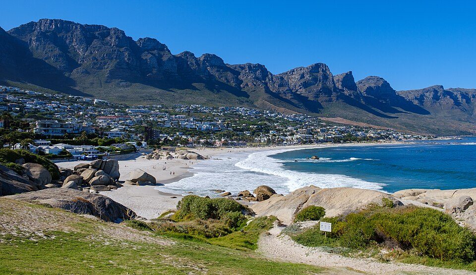
Cape Town, South Africa: Submarine Cable Landing Point
Cape Town, the legislative capital of South Africa and the largest city in the Western Cape province, sits at the southwestern tip of the African continent. Its coastal position on the Atlantic seaboard places it along one of the world's most significant maritime corridors, connecting Africa to the Americas, Europe, and the Indo-Pacific. One submarine cable currently lands at Cape Town, linking South Africa into a wide-ranging intercontinental network that spans multiple ocean basins.
That cable, Project Waterworth, is one of the longest submarine cable systems in the world and connects South Africa directly to Australia, Brazil, India, Malaysia, and the United States. Its presence at Cape Town establishes the city as a node on a genuinely global route, bridging the Atlantic and Indian Ocean corridors within a single cable system.
Cables Landing at Cape Town
Project Waterworth is a submarine cable system with a total length of approximately 50,000 km, currently in draft status. The cable connects Cape Town to landing points in Australia, Brazil, India, Malaysia, and the United States, making it one of the most geographically expansive systems in the submarine cable industry. Its route spans both the Atlantic and Indian Oceans, enabling direct connectivity between South Africa and four other major regional economies across three continents.
Regional Context
Within South Africa's submarine cable infrastructure, Cape Town ranks among the upper tier of landing points by cable count, placing in the top 38% of the country's eight landing points. South Africa hosts 12 submarine cables across seven landing points, with more established hubs such as Amanzimtoti and Mtunzini each hosting four cables, and Melkbosstrand hosting three. Cape Town currently hosts one cable alongside Gqeberha, though Project Waterworth's exceptional length and intercontinental reach distinguish it from other single-cable landing points in the country.
Network Role
Cape Town functions as a single-cable terminus in the current submarine cable graph, serving as South Africa's Atlantic-facing connection point for the Project Waterworth system. The cable's endpoints in Brazil, the United States, India, Malaysia, and Australia mean that Cape Town participates in intercontinental data flows across both major southern hemisphere ocean basins. This positions the landing point at an unusual geographic crossroads: while it hosts only one cable, that system traverses 50,000 km and reaches five countries spanning three continents.
As Project Waterworth moves from draft toward readiness for service, Cape Town's role in South Africa's submarine cable geography will become more defined. In a national network where the eastern and western coastlines share the load of international connectivity, Cape Town's Atlantic position offers a distinct geographic complement to the country's more established landing points concentrated along the eastern and northern coasts.
What next: Cape Town, South Africa in the global directory of cable landing points; see surrounding routes on the interactive submarine cable map or follow live network monitoring.
Other Landing Points in South Africa
Landing Point
- CountryZA South Africa
- Coordinates33.9191°S 18.4220°E
- Connected Cables1
See Real Cable Routes
View actual submarine cable routing from Cape Town, South Africa - with backbone nodes, distance calculations, and latency estimates
Open Calculator →