St. Paul's Bay, Malta
Landing Point · MT Malta
Connected Cables
| Cable | Status |
|---|---|
| GO-1 Mediterranean Cable System | Active |
Live Performance
RTT measurements to this landing point from 2026-04-11 through 2026-10-07 - live ICMP round-trip time via our monitoring probes. Recomputed daily. ✓ No anomalies detected in the monitored period.
Measurement sources
| Probe | Location | Samples | Avg |
|---|---|---|---|
| #50604 | control probe | 139 | 72.2 ms |
| #6762 | control probe | 22 | 50.1 ms |
| #1014969 own probe | Jerusalem IL | 6 | 92.2 ms |
| #1013932 | control probe | 5 | 53.4 ms |
| #6427 own probe | Sydney AU | 4 | 276.0 ms |
| #1014473 own probe | Minsk BY | 4 | 79.9 ms |
| #1014589 own probe | Almaty KZ | 4 | 141.7 ms |
| #1014597 own probe | Tbilisi GE | 4 | 90.0 ms |
| #1015313 own probe | Sevastopol UA | 4 | 108.7 ms |
| #1015932 own probe | Odessa UA | 4 | 72.2 ms |
| #1015984 own probe | Balancer IL | 4 | 84.8 ms |
| #6410 own probe | Sao Paulo BR | 2 | 236.2 ms |
| #6487 | control probe | 2 | 173.9 ms |
| #1015523 own probe | Moscow RU | 2 | 88.5 ms |
| #1015563 own probe | Saint Petersburg RU | 1 | 108.0 ms |
About St. Paul's Bay, Malta
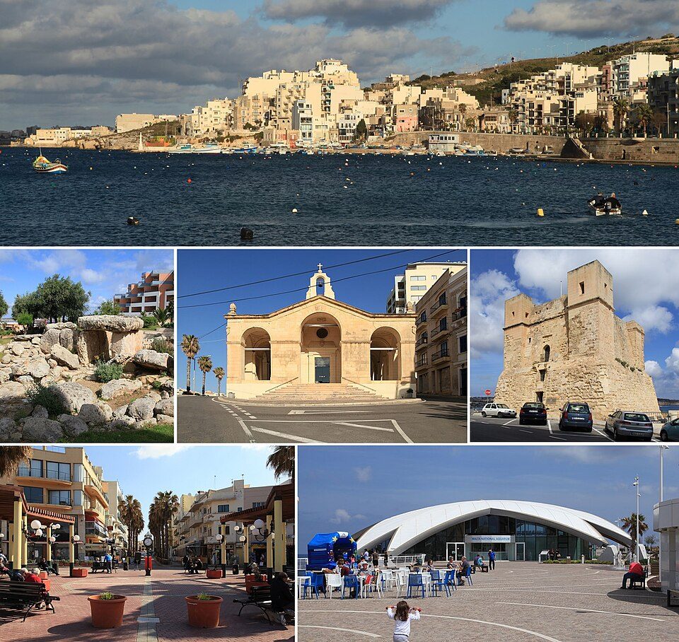
St. Paul's Bay, Malta: Submarine Cable Landing Point
St. Paul's Bay is a town on the northeast coast of Malta, situated within the Northern Region of the island. As a submarine cable landing point, it connects Malta to Italy via a short Mediterranean link, forming part of the broader submarine cable infrastructure that serves the Maltese archipelago. One submarine cable lands at St. Paul's Bay, providing a direct bilateral connection between Malta and its nearest large continental neighbour.
The single cable landing here, the GO-1 Mediterranean Cable System, spans 290 kilometres and represents a relatively compact regional link within the Mediterranean. This corridor connects Malta directly to Italy, enabling an inter-island-to-continent connection across the central Mediterranean. St. Paul's Bay therefore contributes to Malta's overall submarine cable footprint alongside five other landing points distributed around the island.
Cables Landing at St. Paul's Bay
GO-1 Mediterranean Cable System is a 290-kilometre submarine cable that reached ready-for-service status in 2008. The cable connects St. Paul's Bay in Malta to Italy, providing a direct regional link across the central Mediterranean. It is listed with a draft status in cable records. At 290 kilometres, the GO-1 Mediterranean Cable System is notably shorter than the Maltese average cable length of 4,316 kilometres, reflecting its function as a short bilateral connection rather than a long-haul intercontinental route.
Regional Context
Within Malta, St. Paul's Bay ranks alongside Balluta Bay, Golden Bay, and Mgarr ix-Xini as landing points hosting a single submarine cable each. Bahar ic-Caghaq and Mellieha each host two cables, making them the most connected landing points on the island by cable count. With one cable, St. Paul's Bay sits within the top 67 percent of Malta's six landing points by cable count, reflecting a modest but established presence in the country's distributed submarine cable geography.
Network Role
St. Paul's Bay functions as a single-cable terminus, anchoring the GO-1 Mediterranean Cable System on the Maltese side of its Malta-Italy route. This positions the landing point as a contributor to Malta's direct connectivity with the Italian peninsula, complementing the broader set of submarine cables that reach Malta from multiple directions through the island's other landing points. The cable's relatively short length underscores St. Paul's Bay's role in regional rather than intercontinental connectivity.
In the regional submarine cable graph, the presence of a dedicated landing point on Malta's northeast coast reflects the island's strategy of distributing cable landings across geographically distinct locations, reducing concentration risk and ensuring that connectivity to Italy is anchored at a well-established coastal town.
What next: St. Paul's Bay, Malta in the global directory of cable landing points; see surrounding routes on the interactive submarine cable map or follow live network monitoring.
Other Landing Points in Malta
Landing Point
- CountryMT Malta
- Coordinates35.9505°N 14.4156°E
- Connected Cables1
See Real Cable Routes
View actual submarine cable routing from St. Paul's Bay, Malta - with backbone nodes, distance calculations, and latency estimates
Open Calculator →