Santiago de Cuba, Cuba
Landing Point · CU Cuba
Connected Cables
| Cable | Status |
|---|---|
| ALBA-1 | Active |
Live Performance
RTT measurements to this landing point from 2026-03-28 through 2026-10-17 - live ICMP round-trip time via our monitoring probes. Recomputed daily. ✓ No anomalies detected in the monitored period.
Measurement sources
| Probe | Location | Samples | Avg |
|---|---|---|---|
| #7388 | control probe | 147 | 157.7 ms |
| own probe | Minsk BY | 6 | 253.1 ms |
| #6410 own probe | Sao Paulo BR | 4 | 19.7 ms |
| #6487 | control probe | 3 | 390.8 ms |
| #6427 own probe | Sydney AU | 2 | 321.8 ms |
| own probe | Almaty KZ | 2 | 300.1 ms |
| own probe | Tbilisi GE | 2 | 277.4 ms |
| own probe | Jerusalem IL | 2 | 264.4 ms |
| #6568 own probe | Singapore SG | 1 | 373.2 ms |
| #1015496 | control probe | 1 | 158.6 ms |
| #1015500 | control probe | 1 | 159.3 ms |
| #1015501 | control probe | 1 | 146.9 ms |
| own probe | Saint Petersburg RU | 1 | 260.8 ms |
| own probe | Kyiv UA | 1 | 265.6 ms |
About Santiago de Cuba, Cuba
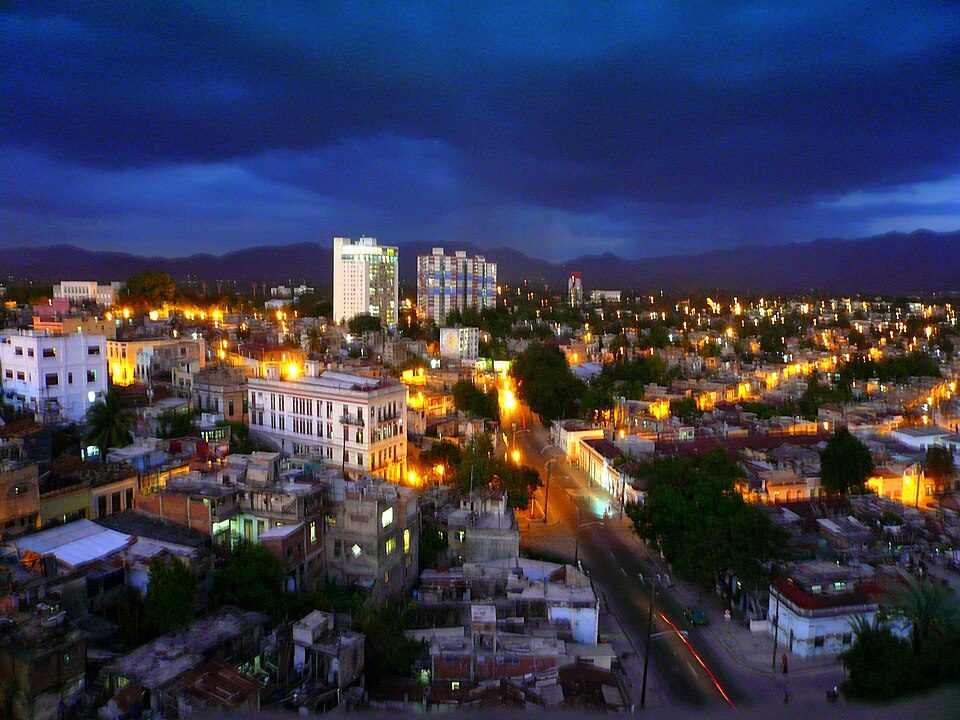
Santiago de Cuba: Submarine Cable Landing Point
Santiago de Cuba is the second-largest city in Cuba and the capital of Santiago de Cuba Province, situated in the southeastern part of the island approximately 870 kilometres southeast of Havana. As a coastal city on Cuba's southeastern shore, it serves as a submarine cable landing point connecting the country to the broader Caribbean region. One submarine cable lands at Santiago de Cuba, linking Cuba to Jamaica and Venezuela through a regional Caribbean corridor.
The single cable landing here, ALBA-1, enables a south-oriented connection that ties Cuba into a network spanning the Caribbean Sea and reaching the northern coast of South America. This positions Santiago de Cuba as a regionally significant point of entry for submarine cable connectivity on Cuba's southeastern coast, serving a corridor that is fundamentally Caribbean and inter-island in character.
Cables Landing at Santiago de Cuba
ALBA-1 is a submarine cable with a total length of 1,860 kilometres, with a ready-for-service date of 2012. The cable connects Cuba, Jamaica, and Venezuela, forming a triangular Caribbean route that links three distinct national territories across the region. Santiago de Cuba serves as the Cuban landing point for this cable, making it the southeastern gateway for this particular international connection. ALBA-1 was among the first submarine cables to become operational in Cuba, with 2012 marking the beginning of Cuba's submarine cable era.
Regional Context
Cuba is served by four submarine cables distributed across four landing points: Guantanamo Bay, Cienfuegos, Siboney, and Santiago de Cuba. Guantanamo Bay hosts the largest number of cables among these, with two, while Cienfuegos, Siboney, and Santiago de Cuba each host one cable. Santiago de Cuba therefore ranks within the top 75 percent of Cuban landing points by cable count, sharing its single-cable status with two other locations around the island.
Network Role
Santiago de Cuba functions as a single-cable terminus rather than a multi-cable hub, with ALBA-1 representing its sole submarine connection. Through this cable, the city provides a direct link between Cuba's southeastern coast and two other Caribbean and South American nations, Jamaica and Venezuela. The route established by ALBA-1 spans 1,860 kilometres, slightly below Cuba's national average cable length of 1,824 kilometres, reflecting the moderate reach of this particular Caribbean crossing.
Within the regional submarine cable graph, Santiago de Cuba's role is defined by the ALBA-1 corridor it anchors on the Cuban side, connecting the southeastern end of the island to a southward arc across the Caribbean Sea. For a country where all submarine cable infrastructure dates only from 2012, Santiago de Cuba represents one of four distinct geographic points through which Cuba participates in the international submarine cable network.
What next: Santiago de Cuba, Cuba in the global directory of cable landing points; see surrounding routes on the interactive submarine cable map or follow live network monitoring.
Our measurements to Santiago de Cuba
Traceroutes from our own measurement points over the last 30 days: usual delay and number of network hops on the way to Santiago de Cuba.
- From RIPE Atlas probes: 88 ms, 8 hops, 13 traces
Last trace: 2026-10-13. Live network map
Other Landing Points in Cuba
Landing Point
- CountryCU Cuba
- Coordinates20.0288°N 75.8290°W
- Connected Cables1
See Real Cable Routes
View actual submarine cable routing from Santiago de Cuba, Cuba - with backbone nodes, distance calculations, and latency estimates
Open Calculator →