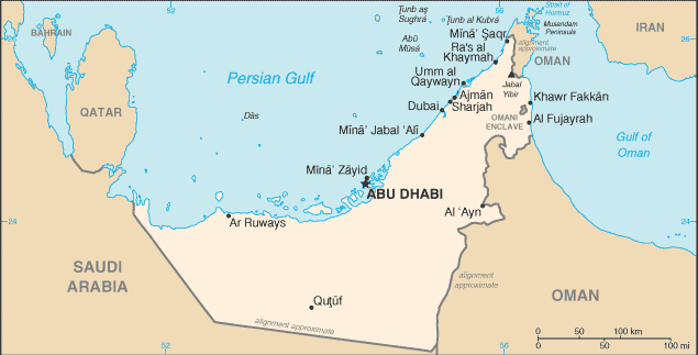
Das Island, United Arab Emirates
Landing Point · AE United Arab Emirates
Connected Cables
| Cable | Status |
|---|---|
| Qatar-U.A.E. Submarine Cable System | Active |
📡 Live Performance
RTT measurements to this landing point from 2026-05-16 through 2026-07-18 - live ICMP round-trip time via our monitoring probes. Recomputed daily. ✓ No anomalies detected in the monitored period.
Measurement sources
| Probe | Location | Samples | Avg |
|---|---|---|---|
| #1014597 own probe | Tbilisi GE | 6 | 260.6 ms |
| #1014969 own probe | Jerusalem IL | 6 | 169.5 ms |
| #6410 own probe | Sao Paulo BR | 5 | 342.8 ms |
| #6427 own probe | Sydney AU | 5 | 166.2 ms |
| #1015984 own probe | Balancer IL | 3 | 187.9 ms |
| #1015313 own probe | Sevastopol UA | 2 | 192.8 ms |
| #1014473 own probe | Minsk BY | 1 | 195.6 ms |
| #1015523 own probe | Moscow RU | 1 | 167.2 ms |
About Das Island, United Arab Emirates
Das Island, United Arab Emirates: Submarine Cable Landing Point
Das Island is an Emirati island situated in the Persian Gulf, lying approximately 160 kilometres north-west of the UAE mainland. Its position places it in relatively close proximity to Qatar, making it a natural waypoint for submarine cable connectivity between the two countries. As an offshore island rather than a mainland coastal city, Das Island represents a distinct node in the United Arab Emirates' submarine cable geography. One submarine cable lands at Das Island, linking it directly to Qatar and providing a short-haul regional connection across the Persian Gulf.
The single cable serving Das Island, the Qatar-U.A.E. Submarine Cable System, reflects the island's role as a point of direct bilateral connectivity rather than a multi-cable international hub. At 100 kilometres in length, this system is a relatively short regional link, consistent with the narrow stretch of water separating Das Island from the Qatari coastline.
Cables Landing at Das Island
The Qatar-U.A.E. Submarine Cable System is the sole submarine cable landing at Das Island. Spanning approximately 100 kilometres, it connects Das Island in the United Arab Emirates with Qatar, making it one of the shorter submarine cable systems in the region. The cable reached ready-for-service status in 2004 and serves as a direct underwater link between the two Gulf states. No additional technical specifications, capacity figures, or fiber pair counts have been published for this system.
Regional Context
Within the United Arab Emirates, Das Island hosts one of the smaller submarine cable presences. The country's 21 submarine cables are distributed across seven landing points, with Fujairah leading significantly at 14 cables, followed by Abu Dhabi with four, Dubai and Kalba each with three, and Sharjah and Sir Abu Nu'Ayr Island each hosting one cable alongside Das Island. Das Island ranks in the upper half of UAE landing points by cable count, though its single cable marks it as a specialised offshore connection point rather than a major national gateway.
Network Role
Das Island functions as a single-cable terminus, serving as the UAE endpoint of the Qatar-U.A.E. Submarine Cable System and enabling direct submarine connectivity between the island and Qatar. Rather than anchoring intercontinental traffic, this landing point supports a short bilateral corridor within the Persian Gulf, connecting Emirati offshore territory to its nearest Gulf neighbour. The cable's 2004 ready-for-service date places it among the earlier-generation systems within the UAE's submarine cable history, which dates to a first landing in 1992.
In the broader UAE submarine cable graph, Das Island occupies a geographically distinct position as an island node separated from the mainland cluster of landing points. Its presence illustrates that UAE submarine cable infrastructure extends beyond the mainland coastline to include offshore island territories, with the Qatar-U.A.E. Submarine Cable System providing Das Island with a direct Persian Gulf crossing to a neighbouring state.
What next: Das Island, United Arab Emirates in the global directory of cable landing points; see surrounding routes on the interactive submarine cable map or follow live network monitoring.
Other Landing Points in United Arab Emirates
Landing Point
- CountryAE United Arab Emirates
- Coordinates25.1526°N 52.8660°E
- Connected Cables1
See Real Cable Routes
View actual submarine cable routing from Das Island, United Arab Emirates - with backbone nodes, distance calculations, and latency estimates
Open Calculator →