Bintulu, Malaysia
Landing Point · MY Malaysia
1
Connected Cables
MY
Country
3.20°
Latitude
113.07°
Longitude
Ctrl + Scroll to zoom
Connected Cables
| Cable | Status |
|---|---|
| Sistem Kabel Rakyat 1Malaysia (SKR1M) | Active |
Live Performance
105
measurements
12
probes
151
days monitored
206.6
ms avg RTT
0
anomalies
RTT measurements to this landing point from 2026-05-09 through 2026-10-07 - live ICMP round-trip time via our monitoring probes. Recomputed daily. ✓ No anomalies detected in the monitored period.
Measurement sources
| Probe | Location | Samples | Avg |
|---|---|---|---|
| own probe | Almaty KZ | 18 | 259.4 ms |
| #6427 own probe | Sydney AU | 16 | 184.8 ms |
| #6410 own probe | Sao Paulo BR | 15 | 361.9 ms |
| #7062 own probe | Cape Town ZA | 15 | 268.9 ms |
| #65901 | control probe | 9 | 56.3 ms |
| #6487 | control probe | 8 | 6.4 ms |
| #65822 | control probe | 8 | 71.0 ms |
| own probe | Tbilisi GE | 6 | 214.2 ms |
| own probe | Minsk BY | 3 | 224.2 ms |
| own probe | Jerusalem IL | 3 | 221.6 ms |
| own probe | Moscow RU | 3 | 200.5 ms |
| #6568 own probe | Singapore SG | 1 | 251.2 ms |
About Bintulu, Malaysia
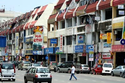
Connectivity in Bintulu: A Coastal Link on Borneo
Bintulu, a coastal town in Sarawak, Malaysia, plays a modest yet important role in the nation's submarine cable network. Situated on the island of Borneo, Bintulu is part of Malaysia's central region, known for its natural resources and growing industrial activities. While it hosts just one submarine cable, the Sistem Kabel Rakyat 1Malaysia (SKR1M), this connection is a key piece of Malaysia's domestic communication infrastructure.The Sistem Kabel Rakyat 1Malaysia: Stitching Malaysia Together
The SKR1M cable, which became ready for service in 2017, spans 3800 kilometers and exclusively connects landing points within Malaysia. It links Bintulu to five other locations: Cherating, Kota Kinabalu, Kuching, Mersing, and Miri. This domestic cable was designed to improve connectivity between Peninsular Malaysia and East Malaysia, bridging the South China Sea to unify the nation's digital infrastructure. Bintulu's role in this chain is particularly notable because of its geographic position. Located roughly 200 kilometers southwest of Miri and 610 kilometers northeast of Kuching, Bintulu serves as a midpoint in Sarawak's regional connectivity. While larger hubs like Kuching host multiple cables (four in total), Bintulu's single cable is sufficient to keep the town connected to Malaysia's broader network.Latency and Performance: A Reliable Connection
GeoCables' latency measurements reveal that Bintulu's connectivity is stable and efficient. Across 29 completed checks from nine source cities, the average round-trip latency to Bintulu is 215 milliseconds, with the best observed latency being an impressive 6 milliseconds. This performance underscores the reliability of the SKR1M cable in facilitating communication between Bintulu and other parts of Malaysia.Bintulu's Importance in Regional Context
Compared to other landing points in Malaysia, Bintulu is relatively modest in terms of cable count. Larger hubs like Penang (with six cables) and Mersing (with five cables) dominate Malaysia's submarine cable landscape. However, Bintulu's single connection is sufficient for its needs, reflecting the town's role as a regional center rather than a national or international hub. Bintulu's economy is largely driven by industries such as energy and natural gas, which rely on stable digital connections for operations and communication. The SKR1M cable ensures that Bintulu remains integrated into Malaysia's domestic network, supporting both local businesses and the broader community.A Domestic Link with Strategic Value
While Bintulu does not host international cables, its connection via SKR1M is a key part of Malaysia's domestic infrastructure. This single cable ensures that Bintulu remains linked to other major cities across the country, supporting the town's growth and its role in Sarawak's development. For a coastal town on the island of Borneo, Bintulu's connectivity is a reminder of how submarine cables can unite even the most geographically dispersed regions.What next: Bintulu, Malaysia in the global directory of cable landing points; see surrounding routes on the interactive submarine cable map or follow live network monitoring.
Other Landing Points in Malaysia
MY Cherating, Malaysia
4.1302°N 103.3937°E
MY Kampung Raja, Malaysia
5.7916°N 102.5717°E
MY Kampung Tekek, Malaysia
2.8164°N 104.1570°E
MY Kiamsam, Malaysia
5.2553°N 115.1689°E
MY Kota Kinabalu, Malaysia
5.9813°N 116.0743°E
MY Kuala Rompin, Malaysia
2.8003°N 103.4915°E
MY Kuala Sedili, Malaysia
1.9259°N 104.1141°E
MY Kuching, Malaysia
1.5202°N 110.3537°E
MY Lumut, Malaysia
4.2285°N 100.6292°E
MY Melaka, Malaysia
2.2732°N 102.2209°E
MY Mersing, Malaysia
2.2955°N 103.8499°E
MY Miri, Malaysia
4.4253°N 114.0074°E
Landing Point
- CountryMY Malaysia
- Coordinates3.1970°N 113.0684°E
- Connected Cables1
See Real Cable Routes
View actual submarine cable routing from Bintulu, Malaysia - with backbone nodes, distance calculations, and latency estimates
Open Calculator →
Submarine cables
Land fiber
Live probes